Leave Your Message
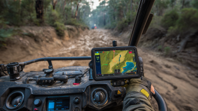
You know, with how quickly geospatial tech is evolving, it’s really shaking up a bunch of industries—especially land surveying and agriculture. The Polaris Rtk Gps system? That’s definitely leading the charge, bringing super high precision and making work way more efficient. I came across this report from MarketsandMarkets that says the global market for precision agriculture might hit around USD 12.9 billion by 2027. That growth is pretty much fueled by more folks adopting tech like RTK GPS. And speaking of reliable gear, Shanghai Apekstool (or APEKS) is doing a pretty great job pushing out cutting-edge GNSS and GPS solutions for professionals. They’re all about helping folks get better accuracy and boost productivity across different fields. As farmers are pushing for higher yields and land surveyors need to get every detail just right, the Polaris RTK GPS isn’t just meeting those needs — it’s raising the bar for what’s possible in the industry.
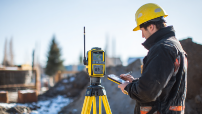
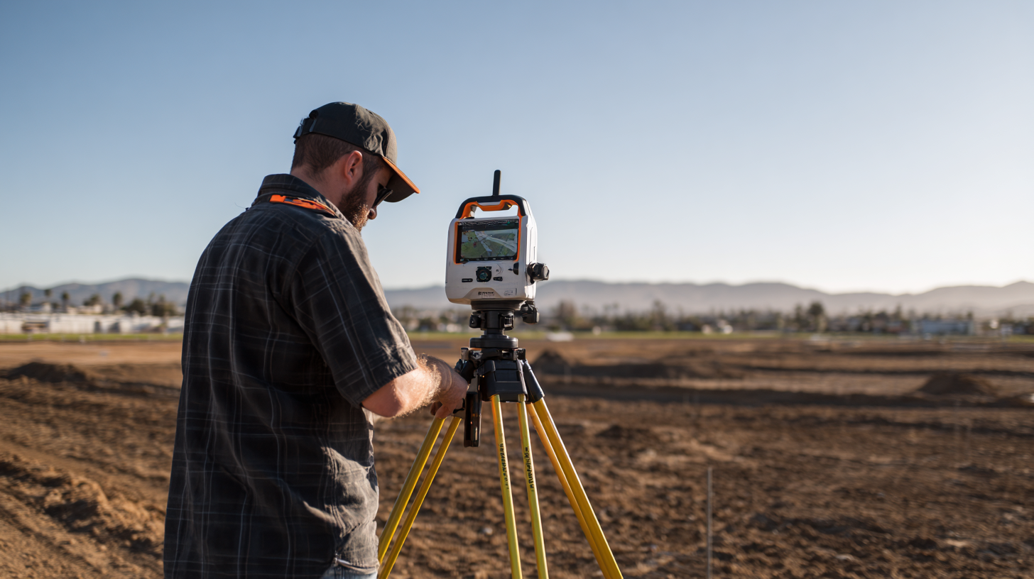
You know, Real-Time Kinematic (RTK) GPS is really changing the game when it comes to Precise Positioning, especially in fields like land surveying and farming. Unlike the usual GPS systems that might only be accurate to a few meters, RTK GPS can get down to centimeter-level accuracy. How? It uses a network of base stations that send real-time correction signals to your mobile GPS receiver. This kind of accuracy is a total game-changer for surveyors who need detailed measurements for marking property boundaries, making topographic maps, or planning construction projects. Thanks to RTK, errors caused by weather or satellite positioning are pretty much minimized, so the data you gather is super reliable and efficient.
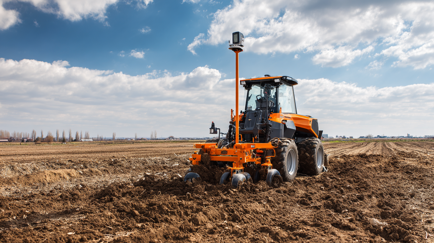
And in farming, RTK GPS is really shaking things up with precision agriculture. Farmers can now fine-tune their field operations—whether it's planting, watering, or harvesting—by making sure their equipment runs within really tight tolerances. That kind of accuracy doesn’t just save money on seeds or fertilizers; it also means better crop quality. Plus, when this GPS data gets plugged into farm management software, farmers have all the info they need to make smarter decisions. Over time, as RTK technology keeps improving, we’re likely to see even more ways it helps with both land surveying and farming—making everything more efficient and sustainable.
All in all, RTK GPS seems poised to make a pretty big impact, helping us work smarter and manage resources better. It’s pretty exciting to think about what’s coming next!
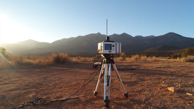
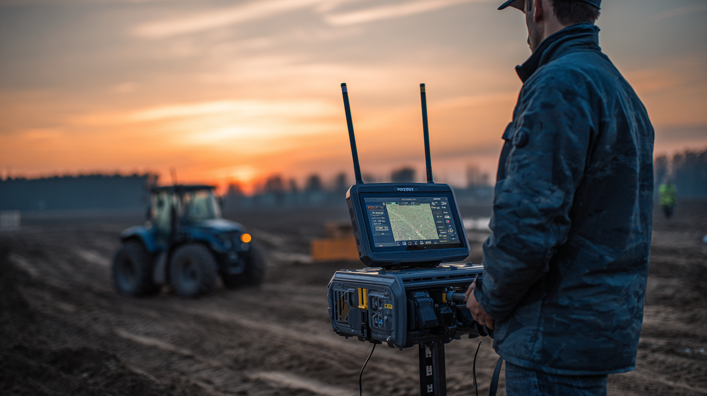
The integration of advanced technologies in geospatial applications has increasingly shaped the way surveying and mapping are conducted, particularly with the introduction of the AP50 Vision IMU-Rtk Gnss Receiver. As highlighted in various industry reports, including those from the Geospatial and Surveying Association, the need for enhanced precision and efficiency in fieldwork has never been more critical, especially in complex environments where traditional surveying methods can falter.
The AP50 Vision utilizes sophisticated photogrammetry technology to effortlessly capture 3D coordinates for hundreds of points within minutes. By leveraging its front camera to shoot videos or photos, professionals can effectively survey difficult-to-access areas that may be obstructed by signals or present hazardous conditions, such as those found under overpasses or near power poles. According to a report by the American Society for Photogrammetry and Remote Sensing, the use of such innovative GNSS receivers has been shown to reduce field data collection times by as much as 50%, significantly improving overall operational efficiency.
This cutting-edge technology not only enhances the speed of data acquisition but also increases the accuracy of measurements collected in challenging conditions. In the context of urban environments, where obstacles abound, the ability to rapidly secure reliable data positions the AP50 Vision as a game changer for surveying and mapping professionals. As reported in the recent Global Geospatial Industry Outlook, the demand for high-precision solutions like those offered by the AP50 Vision is projected to grow steadily, emphasizing the crucial role of advancements in GNSS technology in driving industry standards forward.
: Real-Time Kinematic (RTK) GPS technology enhances positioning accuracy to centimeter-level by using a network of base stations that provide real-time corrections to mobile receivers, minimizing errors caused by atmospheric conditions and satellite geometry.
RTK GPS enables land surveyors to achieve detailed measurements for boundary delineations, topographic mapping, and construction planning, resulting in reliable and efficient data collection.
RTK GPS aids farmers in optimizing field operations, reducing input costs, and improving yield quality by ensuring equipment operates within precise tolerances. This technology promotes data-driven decision-making through integration with agricultural management software.
Polaris RTK GPS offers centimeter-level accuracy and real-time positioning data, surpassing traditional methods that often rely on single-frequency GNSS and lengthy data processing that can introduce errors.
Advanced GPS capabilities allow farmers to optimize planting patterns, irrigation, and resource management, ultimately enhancing crop yields and minimizing waste, leading to more sustainable agricultural practices.
Dual-frequency systems, such as L1/L5 or L1/L2 signals, enhance signal robustness and precision in challenging environments, significantly improving land assessments and crop management compared to traditional single-frequency methods.
By facilitating precision agriculture techniques, RTK GPS helps in maximizing efficiency and productivity while reducing resource waste, thereby supporting sustainability in farming operations.
While the article specifically discusses its applications in surveying and agriculture, RTK GPS technology is versatile and could potentially be adapted for various fields requiring high-precision positioning solutions.
The real-time positioning provided by RTK GPS systems minimizes the likelihood of human error in data collection by providing immediate and accurate results, streamlining the surveying process.
As RTK GPS technology continues to evolve, its applications in surveying and agriculture are expected to expand further, leading to improved efficiency and resource management across various sectors.
Have you ever wondered how modern technology is changing the game in land surveying and agriculture? Well, the article called "Unlocking Precision: How Polaris RTK GPS is Changing the Landscape of Land Surveying and Farming" dives right into that. It starts off by breaking down what RTK GPS technology actually is and why it’s such a big deal when it comes to getting measurements just right. The piece then points out some really cool features of Polaris RTK GPS that help make land measurements way more accurate — making it a must-have for surveyors and farmers alike.
But it’s not just about the tech specs. The article also lays out how Polaris RTK GPS actually makes everyday farm work and land surveying way easier. It’s interesting to see how it stacks up against the old-school methods — not only does it speed things up, but it also helps cut down on mistakes. Towards the end, they talk about how folks are actually using Polaris RTK GPS in their routines, and honestly, it’s pretty impressive how much it’s changing the way things are done, leading to better results and more precise work out in the fields.